Well, the search continues with help from Montezuma Historian Cheryl Longyear and Bill Hecht's site of old photos.You can find the collection that has these top photos here.
The top photo shows the bridge that carried the old West Shore (officially the New York, West Shore, and Buffalo Railway) over the Seneca just north of Montezuma. My guess is that the photo was taken from the old Rochester, Syracuse and Eastern Interurban Trolley line bridge. This bridge is no longer there.
The bottom photo is of the New York Central RR mainline bridge, a much more substantial structure as it carried four tracks across the river. This bridge is still being used.
These two photos show Free Bridge over the Seneca, which is now Route 5 and 20 across the Montezuma Marshes. I include the top photo because it is fairly representative of the style of bridges that were used to cross the river before the Barge Canal. As the river wasn't really used for shipping, the bridges could rest on low piles and be a much simpler structures. Once the Barge Canal was dredged out of the river, the bridges had to be rebuilt and or raised. The 1917 photo of the new "Free Bridge" shows what was built to replace the older crossing. Of course, this bridge was replaced by a newer bridge which is called the Menard Memorial bridge, and now that is now going to be rebuilt. Locals still call it "free bridge".
A series of walking and driving tours covering canal sites in Cayuga County, NY.
Showing posts with label bridge. Show all posts
Sunday, July 21, 2013
Sunday, June 30, 2013
The (Long Gone) Seneca River Bridges of Cayuga County
This was the bridge over the river north of Port Byron on what is now Rt 38. This bridge had to jump two channels, which is why it is so long.
The first was the natural channel that went north around Haiti Island, before it was an island, but just a bump of land surrounded on three sides by the river. The second channel was the man made channel that created really turned Haiti Island into an island for real. A new channel cut off all the loops around the group of islands in this area, and the junction of the Owasco Outlet and Seneca River was moved west.
All these bridges have the decorative panel at the end of the span over the right of way. Does this keep people from climbing up there? Birds from sitting?
My good friend and the Montezuma Historian Cheryl Longyear kindly sent along photos of the Montezuma bridge, which carried Rt 31 over the Seneca. Look at the size difference between the old and new.
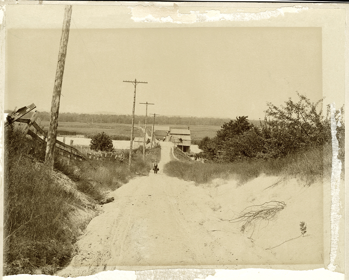
I have included this last one as it does show some of the bridge, but also a boat house that I never knew about.
The man is Arthur Helmer, who if you have ever read "Drums Along the Mohawk" , you would know this man's family and run of Adam Helmer, who is buried in Weedsport.
Here is the Montezuma bridge as it sits today.
Labels:
Barge Canal,
bridge,
Cayuga County,
Erie Canal,
Montezuma,
Seneca River
Sunday, June 23, 2013
The (Seneca River) Bridges of Cayuga County
I was reminded by a friend that one of the old bridges over the Seneca River had a name plate that on it that gave a date of 1913, which would mean that the bridge is 100 years old this year. It certainly points out that we should give some attention to the NYS Barge Canal.
The old Erie Canal passed through the villages of Weedsport, Port Byron and Montezuma. When the new replacement canal was to be constructed, the decision was made to use the Seneca River rather than using the old land cut. In fact, from the Palmyra area east, the entire canal was placed into the river and lake channels that crossed the State. This meant that the Seneca River, Oneida River, Oneida Lake and the Mohawk River would be dredged and made ready to pass boats of 2000 ton burdens.
In Cayuga County, the Seneca River forms the border of the towns of Brutus, Cato, Mentz, Conquest, and Montezuma. The total length of the river in the county is slightly over 15 miles. Nowhere along the line was a settlement as all had been built up around the Erie Canal, AND much of the land around the slow moving river was mucky, wetlands.
The new barge canal was to be 12 feet deep and have a clearance over the water of at least 15-1/2 feet. The navigation channel was to be 200 feet wide, although the river was much wider. This meant that all of the twelve bridges over the river would need to be rebuilt with more substantial structures.
Today three of these bridges remain, although two are no longer open to vehicle traffic. The bridge on Bonta Bridge Road is a single lane, three span structure.
The other two are closed to all traffic. The O'Neil Road bridge is a two span structure that is getting taken over by poison ivy, although a trail does wind its way through the brush and ivy.
The last bridge is the Howland Island bridge. It appears to be the most "beefy" of the three. It is a three span structure that looks wide enough for two lanes.
There will be more to come on the bridges of Cayuga County.
The old Erie Canal passed through the villages of Weedsport, Port Byron and Montezuma. When the new replacement canal was to be constructed, the decision was made to use the Seneca River rather than using the old land cut. In fact, from the Palmyra area east, the entire canal was placed into the river and lake channels that crossed the State. This meant that the Seneca River, Oneida River, Oneida Lake and the Mohawk River would be dredged and made ready to pass boats of 2000 ton burdens.
In Cayuga County, the Seneca River forms the border of the towns of Brutus, Cato, Mentz, Conquest, and Montezuma. The total length of the river in the county is slightly over 15 miles. Nowhere along the line was a settlement as all had been built up around the Erie Canal, AND much of the land around the slow moving river was mucky, wetlands.
The new barge canal was to be 12 feet deep and have a clearance over the water of at least 15-1/2 feet. The navigation channel was to be 200 feet wide, although the river was much wider. This meant that all of the twelve bridges over the river would need to be rebuilt with more substantial structures.
Today three of these bridges remain, although two are no longer open to vehicle traffic. The bridge on Bonta Bridge Road is a single lane, three span structure.
The other two are closed to all traffic. The O'Neil Road bridge is a two span structure that is getting taken over by poison ivy, although a trail does wind its way through the brush and ivy.
The last bridge is the Howland Island bridge. It appears to be the most "beefy" of the three. It is a three span structure that looks wide enough for two lanes.
There will be more to come on the bridges of Cayuga County.
Labels:
Barge Canal,
Bonta Bridge,
bridge,
Cayuga County,
Erie Canal,
Howland Island,
Seneca River
Subscribe to:
Posts (Atom)


